
From Map to Mission: How ABZ Innovation and PIX4Dfields Are Making Precision Spraying Simpler
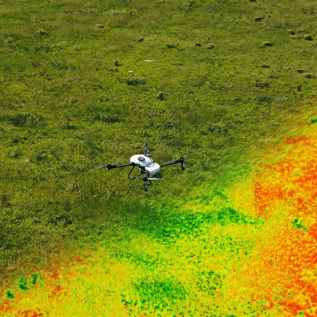
Precision spraying starts long before a drone takes off. It starts with a map. In a recent conversation hosted by Barnabás Martinez, Senior Pilot at ABZ Drone, Julius Petri, Head of Product for Agriculture at PIX4D, and Zsombor Vejtey, Head of RnD at ABZ Innovation, walked through how the two companies’ technologies work together — and why that combination is changing how growers plan and execute spray missions across Europe and beyond.
To watch the video, please fill out the form below.
Why map before you spray
PIX4Dfields turns high-resolution drone or satellite imagery into ready-to-fly prescription maps. As Julius Petri explained during the conversation, mapping a field before an application delivers RTK-accurate boundaries, precise obstacle locations and clearly marked no-spray zones — the details a spray drone needs to fly safely and efficiently, especially around trees, waterways or footpaths that a ground vehicle could simply drive past.
The result is fewer surprises in the field, safer flight paths, and the ability to plan a mission around the exact shape of a field rather than a rough estimate — all of which adds up to less downtime and a more efficient operation.
Built for the field, not just the cloud
One detail that stood out in the discussion: PIX4Dfields runs offline, processing directly on a laptop rather than depending on a cloud upload. For large drone datasets — a single 40-hectare field can generate close to 20 gigabytes of imagery — that difference means minutes of processing instead of hours, which matters when rural connectivity is limited and every hour in the field counts.
A direct line from prescription to drone
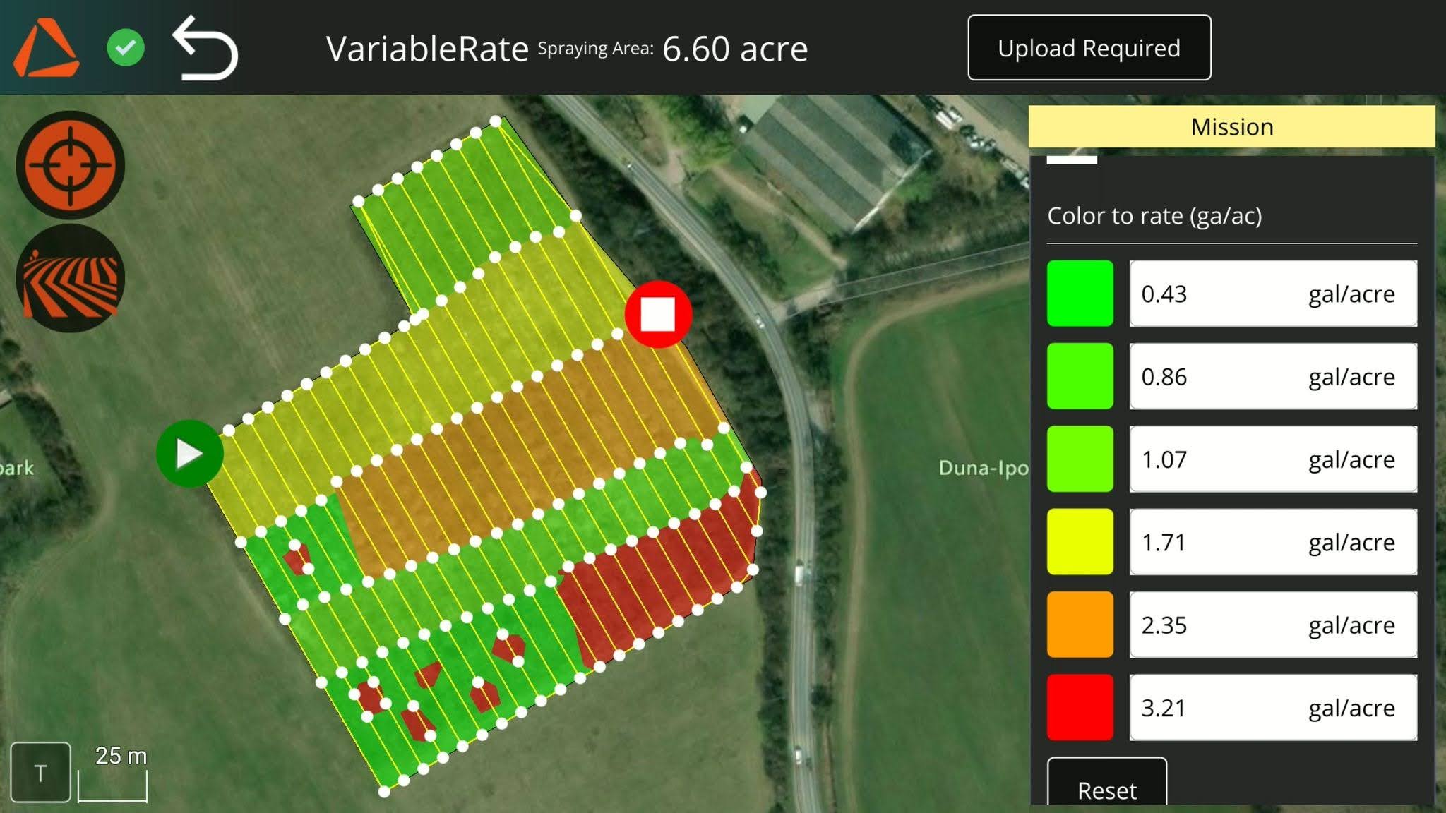
Since integrating ABZ Innovation’s export format in April 2026, PIX4Dfields can generate prescription files built specifically for ABZ drones — automatically adjusting the prescription grid to match what each machine can actually apply, and calculating the exact volume of liquid needed for the mission. Zsombor Vejtey noted that the same variable-rate mission that once took roughly an hour to prepare manually now takes about ten minutes with PIX4Dfields — a difference that becomes significant across dozens of fields in a season.
Real fields, real time savings
The conversation included live examples from ABZ’s own test fields: combining several separate fields into a single mission with a zero-rate zone in between, saving the time otherwise spent relocating take-off points; and a partial-field desiccation mission where only the sections still needing treatment were sprayed, based on a simple, visual split between dry and green areas.
Available today, with more on the way
The integration works with existing ABZ Innovation drones and a standard PIX4Dfields license — no new hardware, software or setup required. Looking ahead, PIX4D and ABZ Innovation discussed what’s next: spot spraying for precisely targeted applications, an upcoming plant-counting feature, and thermal processing for use cases like irrigation leak detection.
Watch the full conversation above, and get in touch with your local ABZ Innovation distributor or our team at marketing@abzinnovation.com to learn how the integration can fit into your operation.
About PIX4D
PIX4D is a global leader in professional reality capture and site-digitization software, providing an end-to-end ecosystem for capture, processing and collaboration across mobile, desktop and cloud applications. Headquartered in Switzerland, with offices in the USA, Germany, Spain and Japan, the company develops solutions that transform images into survey-grade, georeferenced 2D maps and 3D models. PIX4D brings high-precision data capture and processing to surveying, construction, energy and utilities, and agriculture through seamless field-to-office workflows — helping professionals monitor projects, verify accuracy and make data-driven decisions.
About ABZ Innovation
ABZ Innovation develops and manufactures heavy-duty agricultural and industrial drones and accessories for mission-critical operations. Based in Szentendre, Hungary, the company operates in 40+ countries through a global network of distributors and certified service partners. Its product portfolio includes L-Series precision spraying drones, S-Series granule and seed spreading systems, C-Series high-pressure industrial cleaning drones, and M-Series multifunctional industrial platforms — all developed and manufactured in Europe to CE, ISO 9001 and EU C5 standards. ABZ Innovation is backed by its CEO and CCO, along with private individuals, investors and a university, and is currently completing one of Europe’s largest professional drone manufacturing facilities, opening September 2026.


